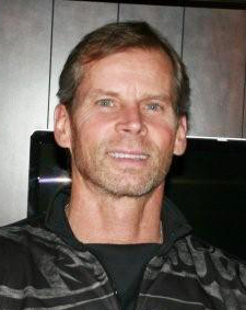

Larry Schaner
Professional Bio
& Employment History
Personal Industry Involvement & Contributions
Over 30 years of geospatial experience specializing in aerial imaging, photogrammetry, LiDAR, terrestrial / close-range photogrammetry, GIS, remote sensing and survey
Team member implementing use of the first terrestrial based “close range” stereo mapping technology performing high positional integrity surveys (Precursor to Terrestrial Laser Scanning – TLS)
Team member participating in production of the first digital color orthorectified images
Appointed as GM of a full-service photogrammetric operation at age 26
Team member introducing airborne LiDAR / imaging technology to the Energy (electric Utility, oil/gas pipeline) Transportation (D.O.T, A/E firms & R/R) Environmental and Forestry disciplines in early 90’s
Assisted in establishing many first LiDAR & Image applications, specifications and standards still being applied in these markets today (including integration of PLS-CAD and Airborne LiDAR)
Part of company introducing first “on-line” raster image storage and retrieval web portal
Acted as a consultant providing technical advisement, application, oversight, and specification and standards development for various emerging geospatial technologies
Co-founded a highly successful Geo-spatial services and consulting company in 2007 – Dissolved in 2009 to start Spatial Innovation, Inc.
Enjoying the many personal and professional benefits of being part of a select list of leaders and professionals within the remote sensing and geospatial industry
Education
Ferris State University
Business Admin & Photogrammetry
Employment History
Spatial Innovation Incorporated – Current
Owner
I am responsible for implementing and growing the Spatial Innovation business model and take personal responsibility to see that each and every agreement we sign is completed successfully. In order to maximize the certainty for success I remain active in all aspects of the day-today operations from overseeing each project, researching technology and performing due-diligence on potential service provider agencies prior to considering their engagement. I stay current on industry activities, conferences, trends and certifications necessary to ensure Spatial Innovation clients have access to best information and solutions available in the industry. Spatial Innovation is specifically designed to bring a higher level of expertise and service to the end user. We’ve streamlined the process through creation of on-line service fulfillment tools that are backed by the industry’s preeminent and niche technologies and providers to guarantee the greatest opportunity for success and value on every project we procure. The full gambit of expertise, technology and services is provided and managed directly through Spatial Innovation. Our company is structured to be equally as effective on international projects, and all is achieved through a single point of contact. Changing tradition to better serve.
Digital Edge International
Co-Owner – President
Established first of its kind consulting and services company. Performed all aspects of business development, technical consulting, project management, technology and business partner due diligence and relationship building with both clients and suppliers. Provided technical assessment of strategic direction and project-based opportunities. Directed continual evaluation and assembly of subcontractors, cost and scope negotiations and developed technical approach for specification and quality compliance. This highly successful venture proved that the client community expects more insight and service than the traditional market offers. (Dissolved partnership to pursue sole ownership and modify business model to further service the end user community.)
Pixxures, Inc.
Vice President
Initially hired as a consultant responsible for identification of new technologies, value-add services and applicable target markets and strategies. Worked as a liaison between sales and operations to improve technical knowledge and communication between departments. Authored technology summaries and white papers on company offerings and industry trends. Acted in technical liaison role to company investors and board of directors. Coordinated technical approach and partnerships to ensure specification and quality compliance. Served on Pixxures’ senior management team assembled to guide the direction and focus of the Company. (Resigned to start a new company and forever “change” the outdated traditional services provider business model.)
John E. Chance & Assoc. (Fugro-USA)
Business Development Manager – Corridor “LiDAR” Mapping
Lead the campaign to introduce the first commercial airborne and terrestrial based LiDAR mapping systems and proprietary application software. Responsible for identifying technology applications, target markets and helped create specifications and standards for applicable industries and disciplines which remain in place to this day. Ground breaking programs were initiated in the Energy, Transportation, and Environmental and Forestry disciplines. (Offered role as President of Corridor Mapping and resigned to pursue new challenges.)
Western Air Maps
SURDEX Corporation (similar role for each company)
Business Development
Established branch sales offices in Kansas, Colorado and California to broaden company market share and generate sales in untapped regions/markets. Functioned as technical representative of all aerial photography, photogrammetric and GIS offerings to a variety of end users including Government, utility, forestry, engineering and environmental. (Resigned to pursue emerging airborne and terrestrial LiDAR.)
Aero-Metric Engineering
Mapping Technician to Office Manager
1982 – 1990 Began as a technician, promoted to department supervisor in 6-months, promoted to Business Development in 24-months and selected to manage the first remote full services company acquisition located in Colorado. Focused on business development to establish office presence and profitability and secured the largest contract of its time – Denver International Airport (DIA) program. (Resigned to pursue new challenges.)
Chicago Aerial Survey – Summer employment
Mapping Technician
Performed all aspects of photogrammetric compilation, image processing, drafting, flight planning and specializing in Analytical Aero-Triangulation (AA/T). Served as AA/T lead on U.S. Government Aid program awarded to the Country of Honduras under the Carter administration. (Discontinued employment to complete photogrammetry degree.)